A bypass bridge proposal could address road closure concerns caused by the flooding of Audley Weir.
Why Audley Weir Floods
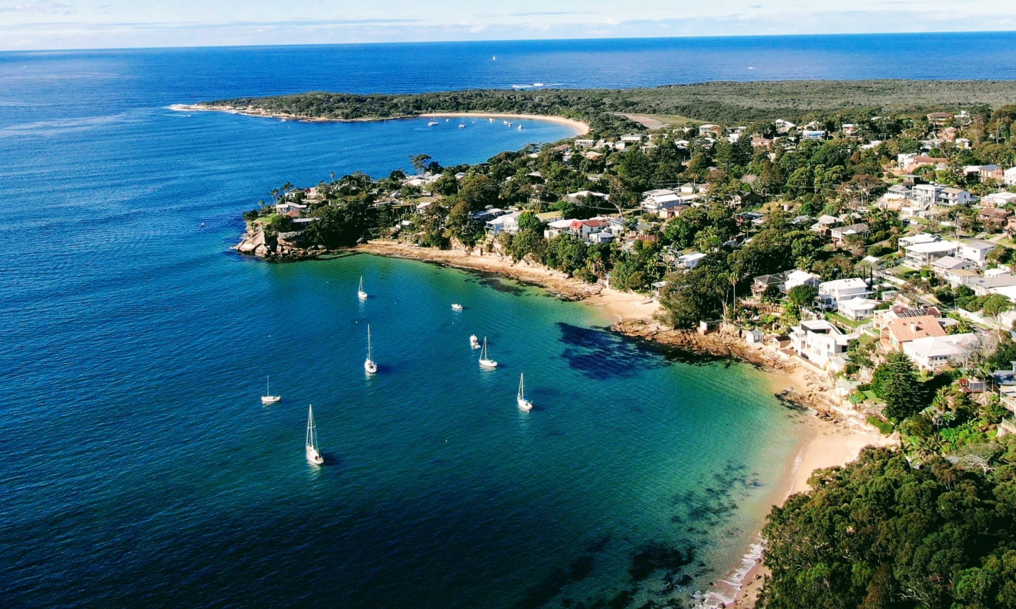
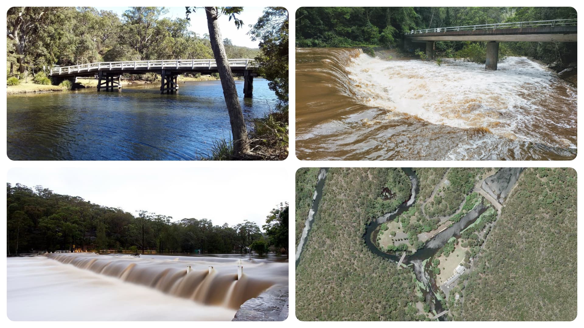
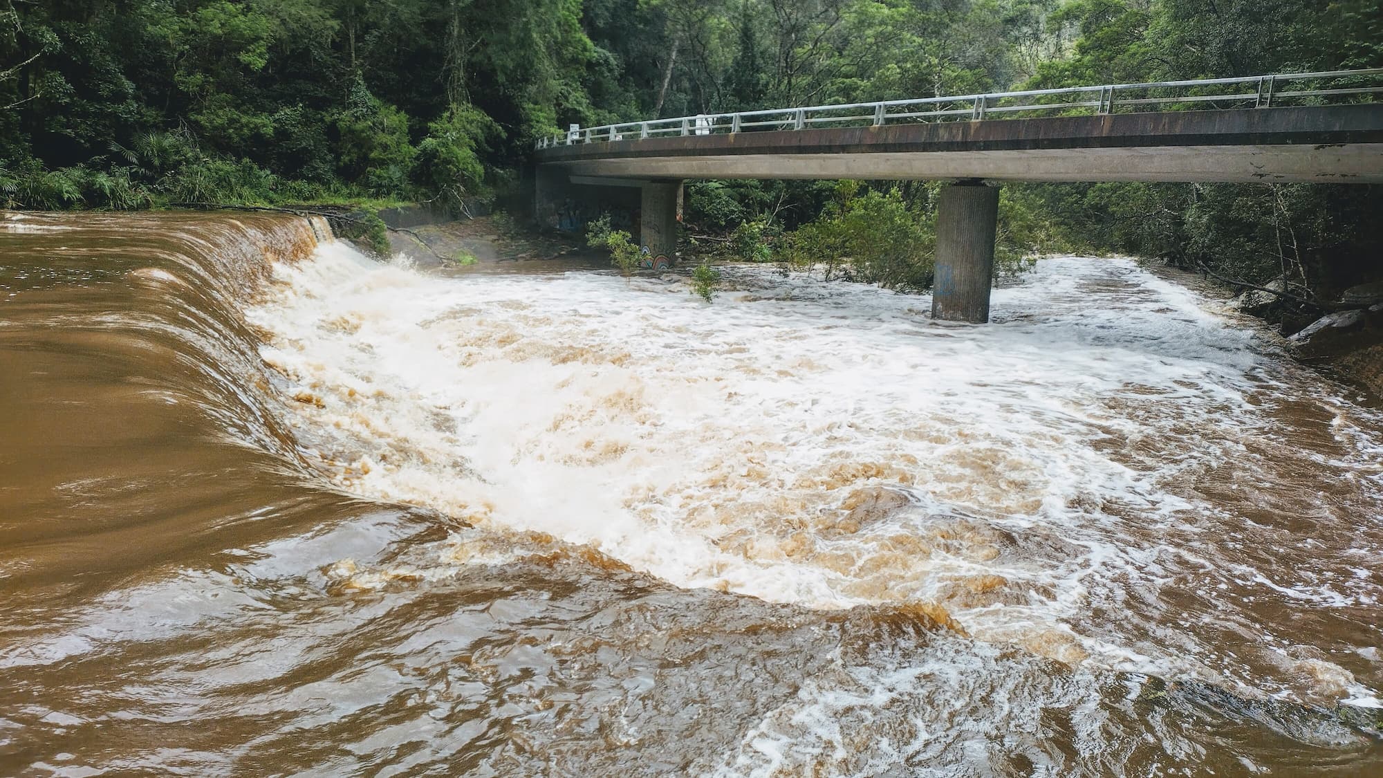
Why does Audley weir flood? The weir is a man made road which crosses the Hacking River. Both the Hacking River and Kangaroo Creek flow into the weir channel. After sustained heavy rainfall the water level can build up to the point that it crosses the weir causing the road to become flooded.
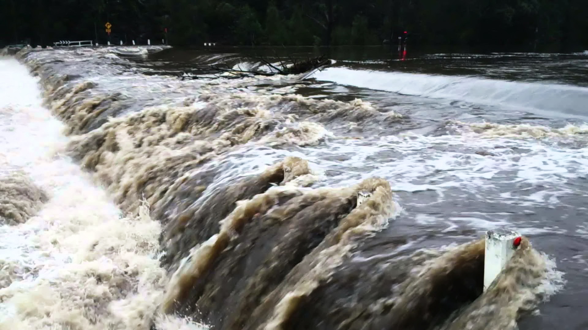
The number of Audley weir flood events varies widely from year to year and is dependant on annual rainfall and weather patterns. Over the last 11 years the number of closures has ranged from one in 2018 to thirteen in 2013. During this period the number of closures has averaged six closures per year. The individual outage times vary from as short as half a day to as much as over 5 days.
With the La Nina weather event in 2022, Audley Weir has already had 5 flooding events in the first three months and has been closed to traffic for more than 25 days.
Why isn’t there already a bridge at Audley Weir?
Audley Weir isn’t the only road in the Royal National Park that floods. The Upper Causeway located underneath the Joan Holland bridge at the intersection of McKell Ave and Sir Bertram Stevens Drive regularly floods in tandem with Audley Weir.
Before the Joan Holland bridge was opened in 1993 road access to Bundeena and Maianbar was only possible via Otford when both Audley Weir and the Upper Causeway flooded. Pre 1993, Bundeena resident Joan Holland led a campaign for alternate road access during flooding. At the time, the preference of residents was for a bridge solution at Audley Weir which would minimise commuting time.
However, in the end the decision was made to build a bridge at the Upper Causeway. Two factors appear to have driven this decision. The first was to maintain the heritage character of the Audley Weir precinct which dates back to the 1800s. It was thought the addition of a bridge would impose on the character of the area and be a possible eyesore.
The other factor was the road engineering complexity and cost required to build a bridge over Audley Weir. Audley Weir is located in a deep valley which starts at the northern end of Audley Road and extends near to the intersection of the Sir Bertram Stevens Drive and Warumbul Road. Creating a bridge which would span this valley would be a major undertaking. A simpler bridge directly over the weir or the raising of the weir may not be structurally sound as well as impact on the heritage factor.
These two factors were expressed by NSW Roads and Maritime Services in a letter to the Bundeena Progress Association in May 2017:
Roads and Maritime has considered raising the Weir or constructing a downstream bridge to alleviate flooding, however, economic analysis carried out revealed the costs for these works would far exceed the benefits to motorists and the options were not supported. Additionally, any height modification to the Weir itself would have adverse impacts on the Audley Historic Recreational Complex which is listed on the NSW State Heritage Register.
Audley Weir Bypass Bridge Proposal
An option which could address concerns over heritage and cost factors is to create a separate bypass bridge over Kangaroo Creek. Access to the bypass bridge would be via the existing entrance road to Audley Boatshed. The entrance road ends at a parking lot which borders the creek.
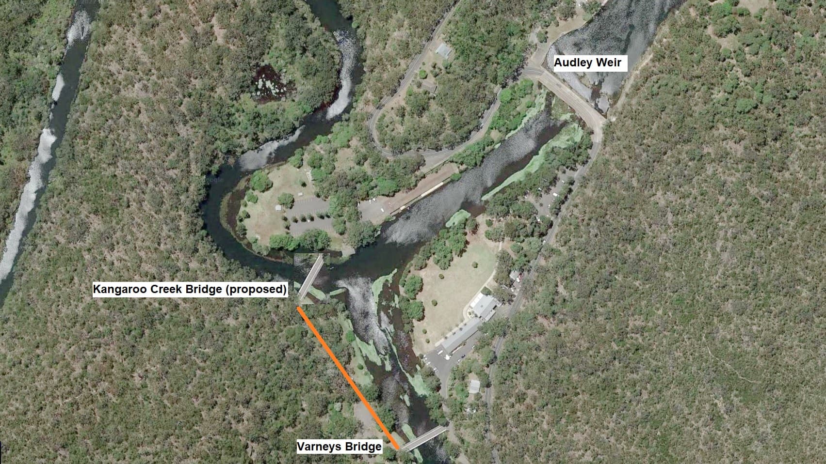
The bypass bridge would be similar in size to the existing Varneys bridge and would crossover Kangaroo Creek from the parking lot. A new short road approximately 200 metres would need to be put in place to connect the bypass bridge to Varneys bridge which leads to Sir Bertram Stevens Drive and bypasses Audley Weir altogether.
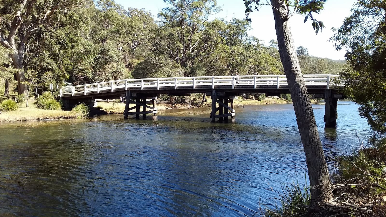
The bypass bridge solution would be sympathetic to the existing heritage character of the Audley precinct and provide a low cost solution. To minimise traffic flows during normal times the bypass bridge could be limited for use only when the weir floods. If desired the costs could be further minimised by disallowing use for heavy trucks.
Related
Audley Weir Management Concerns